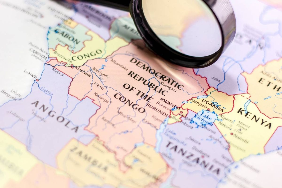
Ivanhoe now holds 175 kilometres of strike in the highly-prospective Western Foreland district that hosts the prolific Kamoa and Kakula copper deposits, the first discoveries within this previously unrecognized region of the Central African Copperbelt
New assay results confirm strike extension of Kamoa North high-grade copper trend for at least 800 metres on Ivanhoe's 100%-owned Kiala Discovery, including copper grades up to 12.40% over 5.53 metres
Ivanhoe now holds 35 kilometres of 100%-owned exploration licences along strike to the north of the Kiala Discovery
New drilling at the Makoko Sud Discovery on the Western Foreland licences west of the Kakula Mine intercepts significant copper mineralization over an additional 7.5 kilometres of strike
Robert Friedland and Yufeng "Miles" Sun, Co-Chairmen of Ivanhoe Mines (TSX: IVN) (OTCQX: IVPAF), announce that the company plans to soon commence an expansive 2021 exploration program on its 100%-owned Western Foreland exploration licences, which include approximately 2,550 square kilometres in close proximity to the Kamoa-Kakula Copper Project in the Democratic Republic of Congo (DRC).
Ivanhoe's DRC exploration group is targeting high-grade Kamoa-Kakula-style copper mineralization through a regional exploration and drilling program on the Western Foreland exploration ground, which shares the same geological setting as Kamoa-Kakula. Ivanhoe Mines' 100%-owned exploration licences cover the ground that Ivanhoe's geological team considers to be the most prospective in the Western Foreland region.
The initial 2021 exploration program includes 40,000 metres of combined aircore and diamond drilling, airborne and ground-based geophysics, soil sampling and road construction. Field work will commence at the start of the 2021 dry season, which typically begins in April. The initial 2021 budget is US$16 million, which may be expanded based on program results. Much of this year's exploration will focus on more than 1,700 square kilometres of new, 100%-owned permits that were acquired in 2019 and received environmental certification in 2020.
"Though the COVID-19 pandemic curtailed our field exploration plans in 2020, we were able to accomplish a significant amount of geophysical surveys and sampling work, which are our key early-stage prospecting techniques for identifying high-priority targets in this part of the Central African Copperbelt," said Mr. Friedland.
"Exploration is in our DNA, and given the outstanding regional prospectivity of our landholdings in close proximity to the Kamoa-Kakula discovery, we are anxious to ramp up our exploration program as aggressively as possible.
"Our record of discovery successes at Kamoa-Kakula is unparalleled, and we have tremendous confidence in the ability and tenacity of our exploration team to leverage our proprietary exploration knowledge to deliver the DRC's next great copper discovery on our 100%-owned ground.
"It was in the spring of 2016 that the team of geologists now leading our Western Foreland exploration efforts made the Kakula Discovery, which has transformed the Kamoa-Kakula Project into the world's highest-grade, major copper mining operation. Given the geological similarities between Kamoa-Kakula and our adjoining exploration ground, which is more than six times larger than the Kamoa-Kakula mining licence, the Western Foreland area is unquestionably one of the most prospective copper exploration districts anywhere in the world.
"While Ivanhoe will soon join the ranks of leading copper producers, our commitment to high-quality exploration with leading-edge technology is core to our long-term business strategy. We view it as our research and development division, designed to provide us with a pipeline of new development opportunities for years to come."
Ivanhoe's geologists applying same exploration models on the Western Foreland licences that successfully led to the discoveries of Kakula, Kakula West, Makoko Sud and Kamoa North Bonanza Zone
Ivanhoe's Western Foreland Exploration Project consists of 17 licences to the north, south and west of the Kamoa mining licences. The 17 licences cover a combined area of approximately 2,550 square kilometres. The primary exploration target in the Western Foreland area is Kamoa-Kakula-style sedimentary copper mineralization that occurs at the base of the lower Nguba "Grand Conglomerate", particularly where the lower Nguba sits in direct contact with the underlying Upper Roan sandstones.
Exploration models that successfully led to the discoveries of Kakula, Kakula West, and the Kamoa North Bonanza Zone on the Kamoa-Kakula joint-venture mining licence, are being applied to Ivanhoe's Western Foreland extensive land package by the same team of exploration geologists responsible for the previous discoveries.
The ideal structural setting for Kamoa-style mineralization usually is close to the western Nguba Basin edge. Deposits occur at the base of the Nguba Group, a widely developed package of rocks that mark the transition from a thick underlying sequence of sediments deposited under oxidizing conditions (good for transporting copper), to deposition under reducing conditions (good for precipitating copper). Ivanhoe's 100%-owned exploration permits cover approximately 175 kilometres of prospective strike in this target setting.
Additional exploration permits increase Ivanhoe's coverage of the most prospective ground
In 2019, Ivanhoe acquired an additional 1,711 square kilometres of 100%-owned exploration permits within the Western Foreland area, solidifying its landholdings of the most prospective ground. In Q2 2020, Ivanhoe received approval for its environmental mitigation and rehabilitation plan for the new permits, allowing exploration work to begin. The new permits, particularly those southwest of Makoko Sud, are located in an area that never before has been explored in any detail with modern exploration techniques. There is limited access to the area and Ivanhoe is planning to construct new bridges and roads to allow its exploration teams into the area. Having such an underexplored area immediately along strike from one of the largest copper deposits in the world, represents a compelling exploration opportunity.
Reconnaissance exploration generating targets for drilling
In addition to drilling in early 2020 at the Kiala Discovery that adjoins the northern boundary of the Kamoa-Kakula mining licence, and drilling in the second half of 2020 at the Makoko Sud Discovery - approximately 20 kilometres west of the Kakula Discovery - Ivanhoe's exploration work in 2020 included stream-sediment sampling, soil geochemical sampling, as well as outcrop and stream mapping on the new tenements acquired in 2019. In total, 411 stream-sediment samples and 958 soil samples were collected and processed for analysis.
The sampling and mapping work has enhanced Ivanhoe's geological understanding of the exploration permits and moves the team closer to generating targets for future exploration and drilling. Ivanhoe's geologists first identified the prospectivity of the Kamoa-Kakula area in the mid-2000s by stream-sediment and soil-geochemical sampling.
A high-resolution magnetic and radiometric survey commenced in Q4 2020 and is ongoing. To date, more than 80% of Ivanhoe's Western Foreland exploration licences have been covered by the survey. In Q2 2021, Ivanhoe plans an Xcalibur airborne gravity survey. The goal of the surveys is to better understand the stratigraphic and structural architecture of the new exploration areas, something that is key to generating early-stage targets for ground surveys.

Western Foreland area looking south from Makoko toward the Zambian Border.
To view an enhanced version of this graphic, please visit:
https://orders.newsfilecorp.com/files/3396/74122_f2f6f4ce849ba961_002full.jpg
Assay results confirm strike extension of Kamoa North high-grade copper trend for at least 800 metres on Ivanhoe's 100%-owned exploration licences at the Kiala Discovery
Mr. Friedland and Mr. Sun also announced that assay results from drilling completed in early 2020 confirm the extension of the Kamoa North high-grade copper structure for at least 800 metres in the Kiala Discovery area, part of Ivanhoe's 100%-owned Western Foreland licences that adjoin the northern boundary of the Kamoa-Kakula mining licence.
The high-grade copper zone at the Kiala Discovery was originally discovered on the Kamoa-Kakula mining licence, and delineated through a series of step-out fences of holes drilled on 100-metre spacings in a northerly direction onto Ivanhoe's 100%-owned exploration licences.
The structure controlling the zone of high-grade copper remains open to the north, and Ivanhoe now has secured 35 kilometres of highly-prospective, 100%-owned exploration ground along trend and to the north of the Kiala Discovery.
Selected drill holes at the Kiala Discovery include:
- DKIA_DD007 intersected 7.21 metres (true width) of 7.98% copper, at a 1% and 2% copper cut-off, from 345.44 metres down hole.
- DKIA_DD011 intersected 3.82 metres (true width) of 5.35% copper, at a 1% and 2% copper cut-off, from 348.00 metres down hole.
- DKIA_DD014 intersected 5.30 metres (true width) of 12.42% copper, at a 1% and 2% copper cut-off, from 366.70 metres down hole.
- DKIA_DD016 intersected 3.59 metres (true width) of 9.71% copper, at a 1% and 2% copper cut-off, from 351.40 metres down hole.
Geology of the Kiala high-grade copper trend
Copper mineralization at Kiala predominantly ocurs at positions where the Kamoa Pyritic Siltstone gradually narrows ("onlaps") across the underlying Roan conglomerate and sandstone unit. The high-grade copper zone is between 50 metres and 150 metres wide, and trends in a north-south direction, co-incident with a series of north-south trending growth faults.
The Kiala area is considered prospective, as two key ingredients to high-grade mineralization occur in this area. First, the faulting is postulated to have provided increased fluid flow of copper-rich brines in this area. Second, the onlap of the basal Nguba Diamictite units has brought the highly-reduced silstone into contact with the Roan aquifer. This favourable combination also has been responsible for Bonanza-style grades in the Kamoa North area of the Kamoa-Kakula Project.
High copper grades have been intersected on four of the five 200-metre-spaced sections completed to date. Copper mineralization at the Kiala Discovery predominantly is chalcopyrite and bornite, with localized minor chalcocite. An upward zonation from bornite to chalcopyrite also is present (see Figure 4).

Figure 1: Plan view of the Kiala high-grade zone showing copper grades.
To view an enhanced version of this graphic, please visit:
https://orders.newsfilecorp.com/files/3396/74122_f2f6f4ce849ba961_003full.jpg

Figure 2: Section Line 1 across the Kiala high-grade copper zone.
To view an enhanced version of this graphic, please visit:
https://orders.newsfilecorp.com/files/3396/74122_f2f6f4ce849ba961_004full.jpg

Figure 3: Section Line 2 across the Kiala high-grade copper zone.
To view an enhanced version of this graphic, please visit:
https://orders.newsfilecorp.com/files/3396/74122_f2f6f4ce849ba961_005full.jpg

Figure 4: Copper grade profiles of recent drill holes in the Kiala Discovery zone.
To view an enhanced version of this graphic, please visit:
https://orders.newsfilecorp.com/files/3396/74122_f2f6f4ce849ba961_006full.jpg
Recent drilling on the Western Foreland licences at the Makoko Sud discovery, due west of the Kakula Deposit, intercepted significant visual copper mineralization over an additional 7.5-kilometre strike length
After restricting exploration drilling activities in early 2020 as a safety precaution to protect employees and drilling contractors from COVID-19, drilling re-commenced in Q3 2020. The 16 holes, totalling 6,871 metres, were drilled to the west of the Makoko Sud Discovery area, which is located approximately 20 kilometres west of the Kakula Deposit.
The drilling intercepted significant, shallow copper mineralization (including up to 6.01 metres grading 3.38% copper) over a 7.5-kilometre strike length in a south-westerly direction along strike from the initial Makoko Sud Discovery area. Road clearance commenced in the second half of 2020 to extend the current exploration opportunities to the south and west from Makoko Sud.
Significant new drill intercepts from Makoko West include:
- DMKK_DD117, a 3.6-kilometre step-out hole from previous Makoko Sud drilling, intersected 6.01 metres (true width) of 3.38% copper, at a 2% copper cut-off from 259.72 metres down hole and 9.75 metres (true width) of 2.63% copper at a 1% copper cut off.
- DMKK_DD118, a 1.6-kilometre step-out hole from previous Makoko Sud drilling, intersected 4.19 metres (true width) of 3.01% copper, at a 2% copper cut-off from 209.50 metres down hole and 5.15 metres (true width) of 2.78% copper at a 1% copper cut off.
- DMKK_DD123, a 7.5-kilometre step-out hole from previous Makoko Sud drilling, intersected 3.33 metres (true width) of 1.44% copper, at a 2% copper cut-off from 570 metres down hole and 17.77 metres (true width) of 1.39% copper at a 1% copper cut off.
The recent Makoko West drilling is extremely significant for the exploration potential of the new exploration permits as it demonstrates that both the target stratigraphy extends westward and that the copper mineralizing system on the western edge of the basin is laterally extensive. Future drilling in the Makoko West area will target specific structural locations that are conducive to developing higher copper grades.
Table 1: Assay composites at 1% and 2% copper cut-off for Kiala drill holes.

To view an enhanced version of this table, please visit:
https://orders.newsfilecorp.com/files/3396/74122_f2f6f4ce849ba961_007full.jpg
Table 2: Location information for the Kiala drill holes.

To view an enhanced version of this table, please visit:
https://orders.newsfilecorp.com/files/3396/74122_f2f6f4ce849ba961_008full.jpg
Table 3: Assay composites at 1% and 2% copper cut-off for recent Makoko West drill holes.

To view an enhanced version of this graphic, please visit:
https://orders.newsfilecorp.com/files/3396/74122_f2f6f4ce849ba961_009full.jpg
Some of the results in Table 3 (marked by an asterisk) are reported as portable XRF (pXRF) results (niton values). Full ICP results are pending for these holes. The procedure used for pXRF results is outlined under the Qualified Person and Quality Control and Assurance section on the following page.
Table 4: Location information for the Makoko West drill holes.

To view an enhanced version of this graphic, please visit:
https://orders.newsfilecorp.com/files/3396/74122_f2f6f4ce849ba961_010full.jpg
Qualified Person and Quality Control and Assurance
Scientific and technical information in this news release has been reviewed and approved by Stephen Torr, P.Geo., Ivanhoe Mines' Vice President, Project Geology and Evaluation, a Qualified Person under the terms of National Instrument 43-101. Mr. Torr is not independent of Ivanhoe Mines. Mr. Torr has verified the technical data disclosed in this news release.
Ivanhoe Mines maintains a comprehensive chain of custody and QA-QC program on assays from its Western Foreland exploration project. Half-sawn core is processed at IME's on-site preparation laboratory and prepared samples then are shipped by secure courier to Bureau Veritas Minerals (BVM) Laboratories in Australia, an ISO17025-accredited facility. Copper assays are determined at BVM by mixed-acid digestion with ICP finish. Industry-standard certified reference materials and blanks are inserted into the sample stream prior to dispatch to BVM.
A number of the results included in this release are based on portable XRF (pXRF) readings (niton values). Samples are pulverized at the project's onsite laboratory, pressed into a pellet and analyzed using a pXRF instrument under controlled conditions. Ivanhoe Mines routinely tests pulps prior to dispatch to BVM with a pXRF instrument and the correlation between the two techniques has demonstrated the pXRF values are reasonably accurate. Nevertheless, the values that are included in this news release are for indicative purposes and should not be relied upon with the same degree of certainty as those reported from a commercial laboratory.
About Ivanhoe Mines
Ivanhoe Mines is a Canadian mining company focused on advancing its three principal joint-venture projects in Southern Africa: the development of major new, mechanized, underground mines at the Kamoa-Kakula copper discoveries in the DRC and at the Platreef palladium-platinum-nickel-copper-rhodium-gold discovery in South Africa; and the extensive redevelopment and upgrading of the historic Kipushi zinc-copper-germanium-silver mine, also in the DRC.
Kamoa-Kakula is expected to begin producing copper concentrate in July 2021 and, through phased expansions, is positioned to become one of the world's largest copper producers. Kamoa-Kakula and Kipushi will be powered by clean, renewable hydro-generated electricity and will be among the world's lowest greenhouse gas emitters per unit of metal produced. Ivanhoe also is exploring for new copper discoveries on its wholly-owned Western Foreland exploration licences in the DRC, near the Kamoa-Kakula Project.
Information contacts
Investors: Bill Trenaman +1.604.331.9834 / Media: Matthew Keevil +1.604.558.1034
Cautionary statement on forward-looking information
Certain statements in this release constitute "forward-looking statements" or "forward-looking information" within the meaning of applicable securities laws, including without limitation, (i) statements regarding the planned 2021 exploration program on the Western Foreland exploration licences, including that the program includes 40,000 metres of combined aircore and diamond drilling, airborne and ground-based geophysics, soil sampling and road construction; and (ii) statements regarding field work will begin at the start of the 2021 dry season, which typically begins in April.
Such statements involve known and unknown risks, uncertainties and other factors which may cause the actual results, performance or achievements of the company, or industry results, to be materially different from any future results, performance or achievements expressed or implied by such forward-looking statements or information. Such statements can be identified by the use of words such as "may", "would", "could", "will", "intend", "expect", "believe", "plan", "anticipate", "estimate", "scheduled", "forecast", "predict" and other similar terminology, or state that certain actions, events or results "may", "could", "would", "might" or "will" be taken, occur or be achieved. These statements reflect the company's current expectations regarding future events, performance and results and speak only as of the date of this release.
All such forward-looking information and statements are based on certain assumptions and analyses made by Ivanhoe Mines' management in light of their experience and perception of historical trends, current conditions and expected future developments, as well as other factors management believe are appropriate in the circumstances. These statements, however, are subject to a variety of risks and uncertainties and other factors that could cause actual events or results to differ materially from those projected in the forward-looking information or statements including, but not limited to, unexpected changes in laws, rules or regulations (including retroactive application), the failure of contractual agreements with the State to be honoured in whole or in part, or in the enforcement or application of laws, rules and regulations by applicable authorities; the failure of parties to contracts to perform as agreed; social or labour unrest; changes in commodity prices, including the price of copper; unexpected failure or inadequacy of infrastructure, or delays in the development of infrastructure, the failure of exploration programs or other studies to deliver anticipated results or results that would justify and support continued studies, development or operations, and the results of economic studies and evaluations. Other important factors that could cause actual results to differ from these forward-looking statements also include those described under the heading "Risk Factors" in the company's most recently filed MD&A as well as in the most recent Annual Information Form filed by Ivanhoe Mines. Readers are cautioned not to place undue reliance on forward-looking information or statements. The factors and assumptions used to develop the forward-looking information and statements, and the risks that could cause the actual results to differ materially are set forth in the "Risk Factors" section and elsewhere in the company's most recent Management's Discussion and Analysis report and Annual Information Form, available at www.sedar.com.
Although the forward-looking statements contained in this news release are based upon what management of the company believes are reasonable assumptions, the company cannot assure investors that actual results will be consistent with these forward-looking statements. These forward-looking statements are made as of the date of this news release and are expressly qualified in their entirety by this cautionary statement. Subject to applicable securities laws, the company does not assume any obligation to update or revise the forward-looking statements contained herein to reflect events or circumstances occurring after the date of this news release.

To view the source version of this press release, please visit https://www.newsfilecorp.com/release/74122


