The Conversation (0)

Emerging gold producer and exploration company Great Divide Mining Ltd (the Company or GDM) (ASX:GDM), is pleased to announce the completion of a second LiDAR interpretation over EPM 26135 Kilkivan, Devil’s Mountain Gold Project, SE Queensland.
Highlights:
Chief Executive Officer, Justin Haines, commented:
“This second LiDAR dataset for Devils Mountain has allowed GDM to get a more accurate picture of all of the historical gold mining at Kilkivan prospects area. Shafts and adits are good indicators of the presence of significant gold and base metal mineralisation, because of the effort invested in producing those old excavations. The LiDAR results confirm GDM’s strategy of targeting areas of abundant historical workings and applying modern exploration technologies to those targets”.
Devils Mountain Project
GDM’s Devils Mountain Project comprises 5 x EPMs (17685, 26062, 26135, 26709, 28438) located ~30 km northwest of Gympie (see Figure 1). The Project lies in the Palaeozoic Gympie and Wandilla Provinces of the New England Orogen in southeast Queensland.
Devils Mountain is highly prospective for gold and is host to an abundance of mineral occurrences. In addition to gold, the area contains occurrences of copper, silver, lead, zinc, tungsten and mercury, as well as a number of manganese deposits (see Figure 2). It’s geological setting has many similarities to the nearby Gympie goldfield.
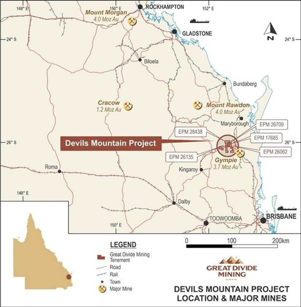 Figure 1: Devils Mountain Gold Project Location Map
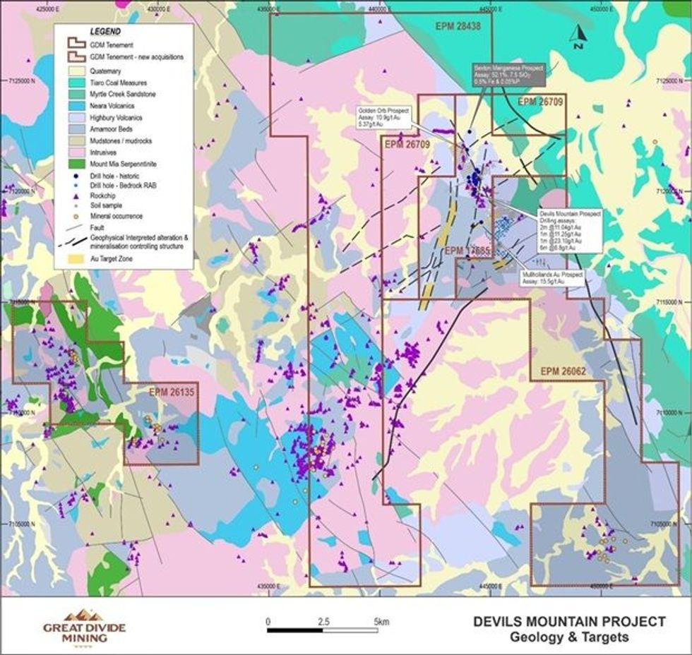 Figure 2: Devils Mountain Project Geology and known historical mining prospects
LiDAR Survey Data
LiDAR specialists GeoCloud Analytics purchased part of the Gympie 2023 LiDAR dataset from the QLD Government on behalf of GDM, over an 80 km2 area in the western part of the Devils Mountain Project, covering EPM 26135. The resolution of the raw data is 1 m. GeoCloud Analytics reprocessed the point cloud data to yield a 50cm resolution bare earth Digital Terrain Model (DTM).
The LiDAR survey was flown in 2023 with a minimum average density of 10.5 points per square metre with an average flying height of 1933m above ground level. Details of the survey are provided in the JORC Table 1, see Appendix 1.
A number of new LiDAR images were generated by GeoCloud Analytics in order to extract more information about the project. The enhanced 3D datasets and 2D images produced have facilitated detailed interpretations, allowing the identification of historical mine workings, prospecting pits, geological structures, access tracks and other surface features such as drill pads.
Click here for the full ASX Release
This article includes content from Great Divide Mining, licensed for the purpose of publishing on Investing News Australia. This article does not constitute financial product advice. It is your responsibility to perform proper due diligence before acting upon any information provided here. Please refer to our full disclaimer here.