The Conversation (0)

Anson Resources Limited (ASX: ASN, ASNOC, ASNOD) (Anson or the Company) is pleased to announce the completion of a 3D Geological model for its Paradox Lithium Project and Green River Lithium Project in the Paradox Basin, in south-eastern Utah, USA.
Highlights:
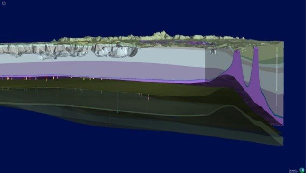 Figure 1: Snapshot of the Paradox Lithium Project 3D Geological Model showing two salt domes (purple peaks) interpreted to have directed the brine flow towards the Project area.
The next stage is to import the 3D geological model into third-party proprietary modelling software package, with advanced capabilities that supports a wide range of grid types, to create a numerical brine flow model for the Project areas.
This will facilitate project planning, permitting, operations and JORC Ore Reserves estimation. The 3D geological model of the Project areas will aid in developing the structure of the groundwater to confirm flow rates. This will feed into the Front-End Engineering and Design (FEED) study currently being undertaken by Anson in conjunction with Worley and Anson’s technology providers.
The brine flow model will be constructed in two phases:
Phase 1: Conceptual Model Development
Phase 2: Develop Numerical Groundwater Flow Model
This article includes content from Anson Resources, licensed for the purpose of publishing on Investing News Australia. This article does not constitute financial product advice. It is your responsibility to perform proper due diligence before acting upon any information provided here. Please refer to our full disclaimer here.